Mustang and High Plateaus
An ancient Buddhist kingdom in the rain shadow of the Himalayas, Mustang stretches from Jomsom to Lo Manthang across ochre plateaus that echo Tibet.
Mustang occupies the northern part of Mustang district, between the Tibetan border and the Annapurna range. Geologically, the region sits in the rain shadow of the Himalayas: monsoon clouds from the south collide with Dhaulagiri (8,167 m) and Annapurna I (8,091 m), leaving the northern plateaus dry year-round. This climatic peculiarity gives the landscape its mineral character: stratified red and grey cliffs, gorges carved by the Kali Gandaki river, and high-altitude plateaus between 2,700 and 4,000 metres where barley and buckwheat survive short summers.
Administratively, Lower Mustang (around Jomsom and Kagbeni, freely accessible) is distinct from Upper Mustang (the ancient kingdom of Lo), a restricted zone requiring a special permit. Upper Mustang remained closed to foreigners until 1992, which preserved a quasi-intact Tibetan-inspired culture: its inhabitants, the Lobas, speak a dialect close to Kham Tibetan, practice Buddhism of the Sakya and Nyingma schools, and live in flat-roofed whitewashed earth houses.
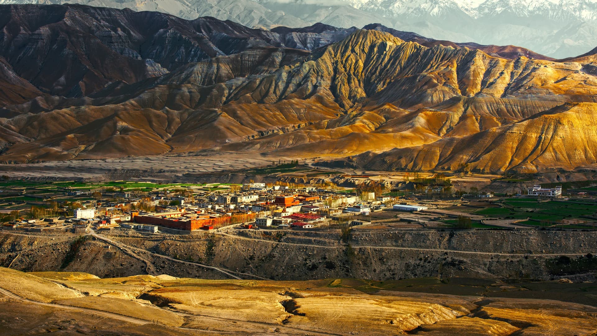
Lo Manthang, the historic capital, stands at 3,840 metres. The fortified city, founded in 1380 by Ame Pal, retains its original walls and four major monasteries: Jampa Lhakhang (15th century, famous for its 14-metre Maitreya Buddha), Thubchen, Chode, and Choprang. Murals here date from the 15th century and were restored in the 2000s by the American Himalayan Foundation. Around Lo Manthang, several valleys reward exploration on foot or horseback: Chhoser with its troglodytic caves carved into the cliff face (Jhong Cave has five storeys), Garphu and its Nyingma monastery, or Yara and the Luri Gompa hermitage, a sanctuary carved into rock at 4,000 metres.
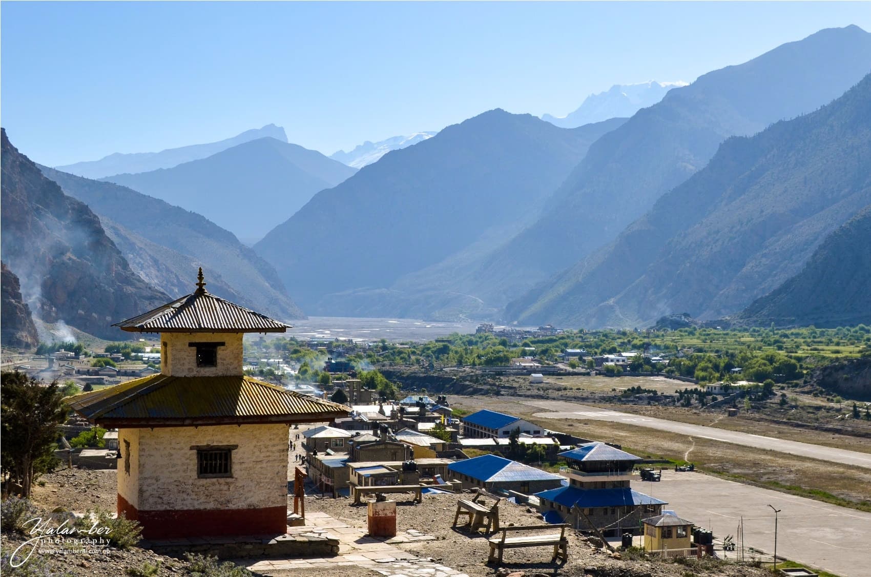
The journey almost always begins in Jomsom, the district capital, accessible by a 20-minute flight from Pokhara (small propeller planes, sensitive to winds that pick up daily around 11am in the valley). From Jomsom, the trail climbs the Kali Gandaki towards Kagbeni (2,800 m), gateway to Upper Mustang, then crosses Chele, Syangboche, Ghami, and Tsarang before reaching Lo Manthang. This section can be walked in 5 to 6 days, mountain-biked for the athletic, or driven in 4x4 since the gradual opening of the carriage road. Our team in Kathmandu still recommends trekking for the quality of village contact: the road speeds travel but disrupts the rhythm of traditional stages.
Cuisine reflects resource scarcity: thukpa (noodle soup with yak or goat meat), tsampa (roasted barley flour), salted butter tea, buckwheat dhindo. Marpha, a village south of Jomsom, is known for its apple orchards introduced in the 1960s and its locally distilled apple brandy. Monastic festivals punctuate the calendar: Tiji, the most striking, is held over three days in May at Lo Manthang. Monks dance in embroidered costumes to expel demons and celebrate Dorje Jono's triumph over evil. It's when Lobas from neighbouring valleys often arrive on horseback.
Economically, Mustang long lived from caravan trade between Tibet and the Ganges plains, Tibetan salt exchanged for Nepalese grain. This route died with the closure of the Chinese border in 1959. Today, income comes from regulated tourism, livestock (yaks, pashmina goats, horses), and seasonal migration to Pokhara and Kathmandu. The region remains sparsely populated: roughly 14,000 inhabitants across the entire district.
Must-See
Lo Manthang and its 15th-century monasteries. The fortified city at 3,840 metres retains its original walls and four gompas including Jampa Lhakhang, housing a 14-metre Maitreya Buddha and restored murals dating from the 15th century.
Troglodytic caves of Chhoser. An hour north of Lo Manthang, the Jhong Cave cliff has five levels of cavities carved nearly 2,000 years ago, accessible by wooden ladders, with views over the Nechung valley.
Tiji Festival at Lo Manthang. Three days of masked dances on the central plaza in May, where monks from Chode monastery re-enact Dorje Jono's battle against evil. Dates vary by Tibetan lunar calendar; book six months in advance with us.
Trekking the Kali Gandaki from Kagbeni. The river carves the world's deepest gorge between Dhaulagiri and Annapurna. The walk crosses Chele, Syangboche, and Ghami on ochre trails, with passes at 4,000 metres.
Marpha and its apple brandy. A Thakali village with flagged lanes south of Jomsom, known for its 1960s-introduced orchards and a visitable artisanal distillery—a useful stop to acclimatize on the descent.
When to Visit
Mustang is visited from May through early November, with one distinctive feature setting it apart from the rest of Népal: the June-to-August monsoon here is greatly diminished, with roughly 200 mm of rain for the season versus 2,000 mm on the southern foothills of the Annapurnas. It's therefore the country's only trekking region accessible in the height of summer. At Lo Manthang, daytime temperatures range from 18 to 22°C in July, dropping to 5-8°C at night. May and June coincide with the Tiji festival and offer long days, clear mornings, and sustained afternoon winds. September and October deliver the clearest skies after monsoon's end, with daytime temperatures around 15°C and nights near 0°C at Lo Manthang.
From December to March, the region empties: passes close with snow, many families descend to Pokhara for winter, and lodges reduce services. April is an intermediate season, still cold at altitude but already pleasant in Lower Mustang. Daily valley winds pick up around 11am and can reach 50 km/h in the Kali Gandaki gorge, which is why Pokhara-Jomsom flights are scheduled early morning and frequently delayed or cancelled.
Practical Advice
Upper Mustang requires a special permit at 500 USD for 10 days, plus 50 USD per additional day, which our Kathmandu agency secures with original passports. This permit is issued only to guided groups (minimum 2 travellers on paper, circumventable for solo travellers through our structure). Budget 12 to 14 days on site for a complete itinerary: 2 days in Kathmandu at the start, flight to Pokhara, flight to Jomsom, 8 to 10 days of trekking round-trip to Lo Manthang with gradual acclimatization, and 2 or 3 days on site to explore Chhoser, Garphu, and lateral valleys. A shortened 4x4 version is possible in 7 days for travellers with limited time, but it limits village contact.
Accommodation is in Thakali or Loba lodges, clean but modest: 2-bed rooms, shared facilities, bucket hot water at most stops, intermittent solar electricity. Altitudes remain moderate for Himalayan trekking (Lo La pass at 3,950 m), with no technical difficulty, but daily effort and dryness demand good fitness. The region suits travellers already familiar with Népal or those seeking a cultural high-altitude itinerary without the crowds of the Annapurna Circuit. Logical combinations: 3 days in the Kathmandu valley before departure, a few days around Pokhara and the Annapurnas on return to decompress, or an extension into Chitwan in the Terai to contrast landscapes with low-altitude jungle. Everest and the Khumbu combine poorly in the same trip; flight logistics are too time-consuming.